What Locahun 3D's 3D data is,
and how each discipline puts it to work.
DATA & USE — INDEXP. 01 / 07
CHAPTER 01— WHAT IS 3DGS —
CH. 01What is 3D Gaussian Splatting?
A new 3D representation that brings
a space back exactly as it is.
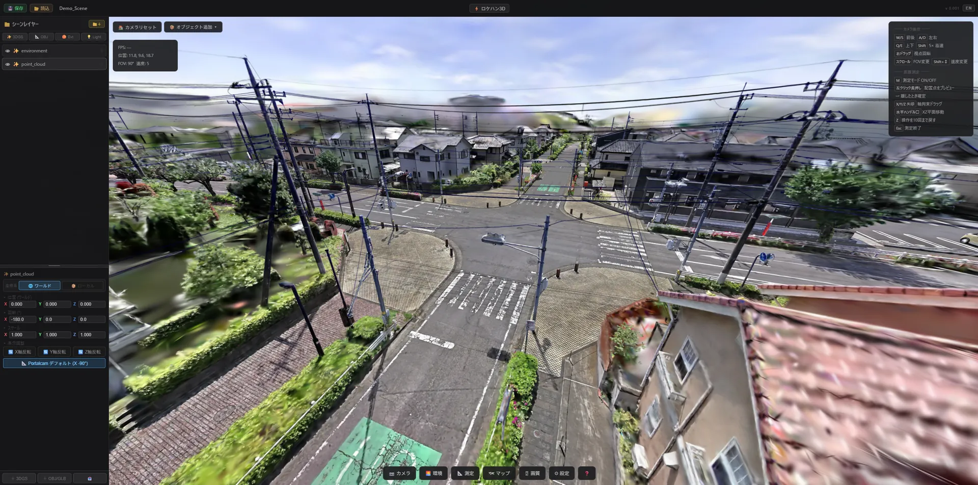
3D Gaussian Splatting (3DGS) is a technique that
densely reconstructs real space from multi-viewpoint photos and video.
— 3DGS DEMO VIEW
01 / PHOTOREAL
Optical Photorealism
Translucent objects, reflections, and subtle lighting changes that were hard to capture with conventional mesh + texture are preserved just as they looked at the time of capture.
02 / REALTIME
Real-Time Rendering
A high-speed rendering method close to rasterization lets you move the viewpoint without the heavy inference of NeRF. It ties directly to the speed of decision-making.
03 / PORTABLE
Lightweight Delivery
A few tens to a few hundred MB per scene. Because it runs on WebGL / WebGPU, you can build a delivery format that anyone can open on just an iPhone, Mac, iPad, or Laptop.
WHAT IS 3DGSP. 02 / 07
CHAPTER 02— FORMAT & SCAN —
CH. 02Supported Formats & Capture Methods
We work in .ply&.Rad
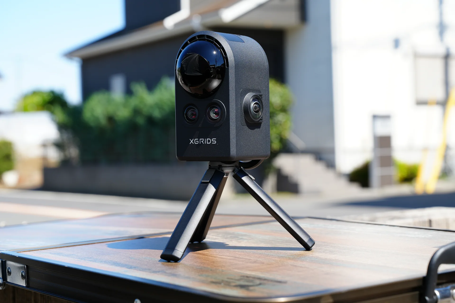
Capture is by XGRIDS PortalCam
Interoperable with major training, editing, and delivery software.
Capture centers on the XGRIDS PortalCam,
using SLAM-based scanning of real spaces.
— XGRIDS PORTALCAM · SLAM SCANNING
02 / SCAN — CAPTURE METHOD
SLAM Scanning with the XGRIDS PortalCam
The XGRIDS PortalCam is a SLAM-type handheld / wearable scanner that integrates LiDAR with multiple cameras. Just walking through a space outputs it in Gaussian Splatting format.
MethodLiDAR + Multi-cam SLAM (real-time localization)
RangeContinuous scanning from a single interior room to block scale (outdoor 100m+)
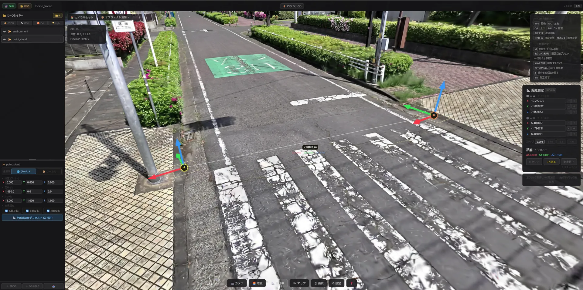
Accuracycm-order point-cloud accuracy. Practical enough as a baseline for distance measurement
SpeedRoughly 5–10 min per room / 15–30 min for an outdoor location
Output Size50–500 MB / scene (small interior to mid-size block)
+ DRONE CAPTURE
For wide-area locations or spots you can't reach on foot — rooftops, waterfronts, level changes —
we also support 3DGS reconstruction from drone aerial capture (multi-viewpoint shooting).
Combined with the PortalCam's ground scan,
you bring back a seamless 3D space spanning sky ↔ ground in one pass.
Captured 3DGS carries straight through to compositing, previz, and lighting
— reusable as-is.
3DGS data isn't limited to location scouting.
Bring it into tools like Blender / Unreal / Unity / Maya / After Effects
and you can span 3D tracking baselines, animation previz, lighting checks,
and downstream VFX compositing — all from a single set of real-space data.
01 / TRACKING
3D Tracking Baseline
Because 3DGS is captured at real-world scale, it can be used directly as a geometry baseline for
camera tracking and 3D compositing in After Effects / Mocha / SynthEyes /
Blender. Alignment accuracy with live-action footage improves dramatically.
02 / PREVIZ
Animation Previz
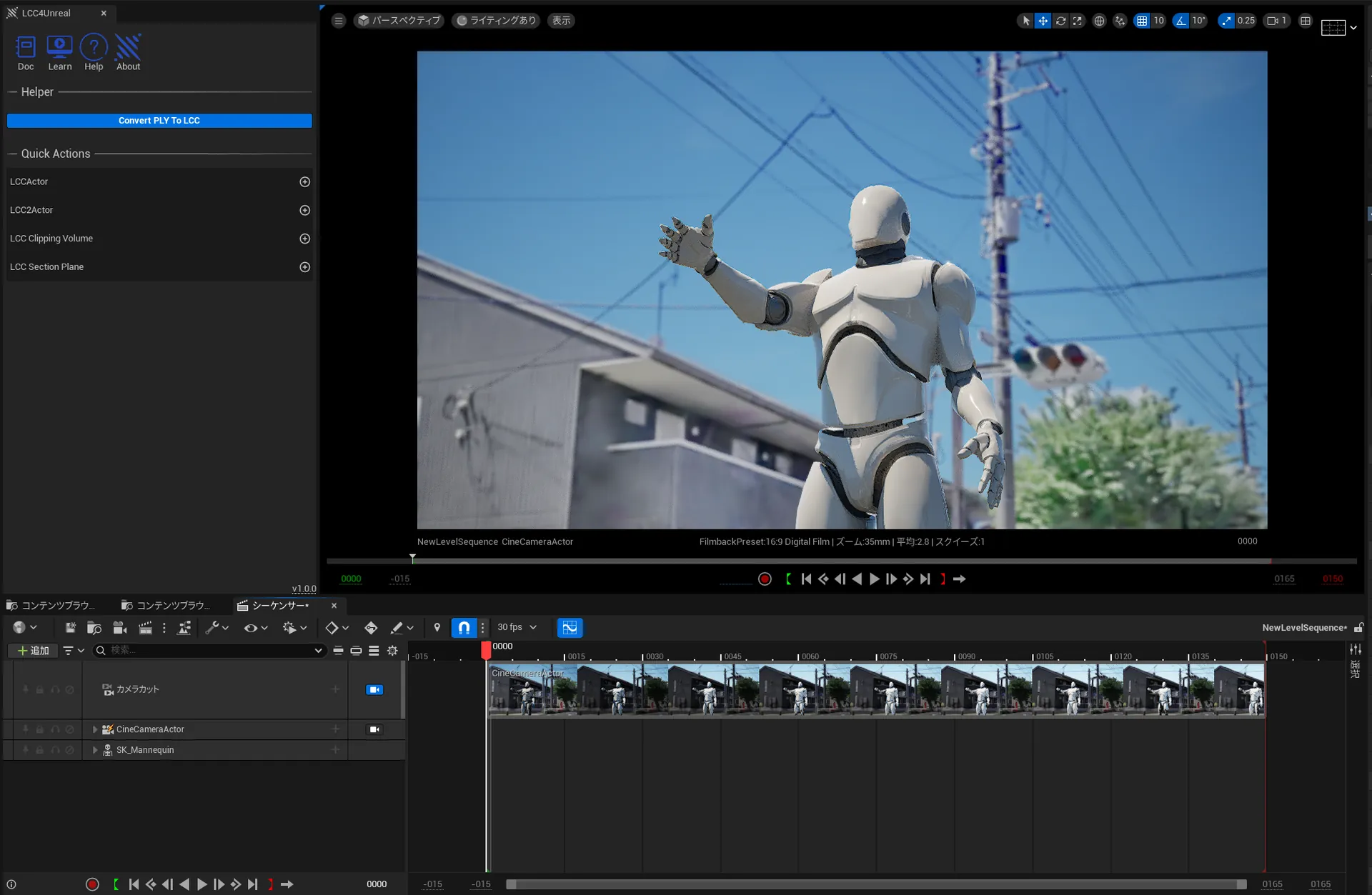
Import into Unreal Engine 5 / Blender / Maya and pre-check CG characters and camera moves
overlaid on real space. Because you can nail down blocking, runtime, and angles before the shoot,
the speed of on-the-day decisions is on another level.
03 / LIGHTING
Lighting & Visualization
Because 3DGS is specialized for lightweight, real-time rendering,
you can swap environment light or a pseudo-HDRI and instantly iterate on time of day, weather, and light placement.
It also works well as a simulation environment for the art and lighting departments.
BEYOND SCOUTP. 04 / 07
CHAPTER 04— CHROME APP —
CH. 04The "Locahun 3D" Chrome Application
No installation required.
Open it in your browser and start right away.
CHROME APPLICATION
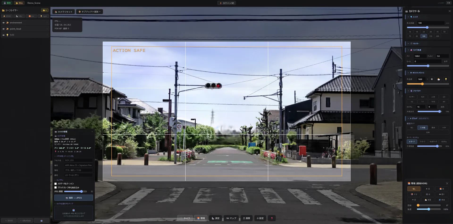
"Locahun 3D" is a 3DGS viewer and virtual-camera application that runs inside the Chrome browser. Just drag and drop a scanned .ply / .Rad file, and real-device-grade lens simulation, distance measurement, environment lighting, and metadata-tagged JPEG export are all completed inside the browser.
⚡
No Installation Required
Launches instantly with just Chrome. Common to Mac / Windows / Linux. Roll out the same environment to your whole crew at once.
🛡
Local Processing
3DGS data stays entirely within the browser. No uploads to a server — safe even for confidential locations.
💻
Runs on Any Device
Windows / Mac / iPad / iPhone — check on the same viewer from any device. Crew can review instantly on whatever gear is at hand.
📡
Works Offline
After the first load, save the PF and it runs with no internet connection. Works on location, in transit, or for indoor shoots with no signal.
On rainy days, scanning may not be possible for equipment reasons, so the date and time may be changed.
For drone surveys, a preparation period may be required due to flight-permit arrangements.
If shooting dates clash, we may need to adjust the date and time.
For locations far from the Kanto region, we may charge separate travel expenses depending on the situation.
If there is a better approach than 3DGS, we will suggest it. On request, we can connect you with partner companies.
If you have a vision you'd like to realize beyond 3DGS representation, please feel free to get in touch.
— LOCAHUN 3D —
SCAN CONDITIONSP. 06 / 07
PART 02 / APPLICATIONS— FOR YOUR DISCIPLINE —
PART 02Applications — how it lands by discipline
The same 3D data, in the words
that actually land — by discipline.
How to actually use this data on set. Anime production, art department, production,
the camera department, VFX, and studio operation — each connects to your workflow
at real scale and real coordinates.
For 01— ANIME PRODUCTION —
Bring real space into the layout stage. Lock the anime "shot" before you film.
3DGS data carries straight through layout → key animation → 3D compositing.
It plugs into your AE / Blender / Maya / UE5 pipeline at real scale and real coordinates.
— 6 USE CASES —
6 scenes where it makes a concrete difference in anime production
UC-01
On-location reference for background art
Beyond the photo records your location researchers bring back, you take home the real-scale 3D space itself. Spatial inconsistencies are prevented in downstream BG painting.
UC-02
Angle design for layout
From storyboard → layout, try out focal length, pan and tilt inside the real space. Layout instructions to your key animators gain resolution.
UC-03
Compositing mecha and characters into real locations
With real-scale 3DGS + Unreal / Blender, run previs compositing of CG mecha into the real location. Lock movement lines, sightlines, and scale before the shoot.
UC-04
A reference for the 3D compositing pipeline
Bring 3DGS data into AE / Mocha as a 3D tracking reference — the grounding data for live-action plate compositing and perspective alignment.
UC-05
Building a location library
Stations, downtown districts, tourist spots, studios you shoot often — scan once and own it forever. Reusable across sequels, spin-offs, and multiple titles.
UC-06
An alternative to distant and overseas location trips
For locations that are hard to visit, acquire scans through our partner network. Dramatically cuts research costs for titles set overseas.
— KEY TOOL INTEGRATIONS —
Interoperable with major DCC and compositing tools
PIPE 01 / LAYOUT
Blender / Maya
Load .ply via a 3DGS add-on and reuse it for camera design in the layout stage. Everything up to locked-off angle output for key animation is done in the browser + Blender.
PIPE 02 / COMP
After Effects
Anchor camera-tracking data from Mocha / SynthEyes / Blender to the real scale and real coordinates of the 3DGS. Alignment accuracy with 3D layers improves.
PIPE 03 / PREVIZ
Unreal Engine 5
Import the 3DGS as-is and pre-check CG mecha and characters layered into the real space. Lock movement, runtime, and angles before the shoot.
— UE5 / BLENDER / AE — DROP-IN INTEGRATION
For 02— ART DEPARTMENT —
Validate the set before build day. Don't bet load-in and dressing on the day.
Take the venue, studio, or location home as 3DGS, and overlay your set design, load-in routes, dressing layout, and lighting plan to validate before build.
Crush the mismatches you'd otherwise discover on site — at your desk, first.
— 6 USE CASES —
6 scenes where it makes a concrete difference in set design and on-site build
UC-01
Consistency checks for set design
Drop the set 3D onto the venue's cm-accurate real space. Platforms that collide with a protruding pillar, leg curtains that block an opening — all caught at the design stage.
UC-02
Pre-visualization for live and stage art
Sightline cutoffs from the audience, blind spots stage-left/stage-right, the drop position for the riff — validate from changing viewpoints, all settled at the design stage.
UC-03
Load-in routes, ceiling load, power planning
Truck parking, door widths, corridor protrusions, the ceiling lighting grid, outlet positions — measure it all, then design.
UC-04
Layout preview for dressing and props
The art director provisionally places dressing inside the 3D space. Eliminate the "it looked different once we tried it on site." Locked before you order.
UC-05
Overlaying the lighting plan
Overlay the lighting team's HDRI / fixture-position plan onto the same 3DGS data, and check shadows, reflections, and sightlines for consistency in advance.
UC-06
Building consensus with the director
Explain with viewpoint images from inside the 3D space, not elevation drawings. Revision notes gain resolution, and retakes drop.
— KEY TOOL INTEGRATIONS —
Interoperable with the set-design process
PIPE 01 / DESIGN
SketchUp / Vectorworks
On the real-space base exported from 3DGS, place sets, dressing, and fixtures in 3D. The gap between elevation drawings and the finished look disappears.
PIPE 02 / 3D
Blender / Maya
Load .ply with the 3DGS add-on and pre-check lighting and perspective. For aligning CG previs with set design.
PIPE 03 / SHARE
FHD JPEG with metadata
For design reviews and on-site briefing materials, output images carrying viewpoint and camera info. Shared materials for the venue and the build team.
— DISTANCE MEASURE · CM-LEVEL · IN BROWSER
For 03— PRODUCTION —
Materials that connect to the set. Win the pitch and the shot list with 3D.
Client proposals, location comparisons, the rationale behind your shot list — hand "what the final shot will actually look like" to your team and client as images, before the shoot.
Close the gap between production's decision speed and the set's resolution.
— 6 USE CASES —
6 scenes where it makes a concrete difference in production work
UC-01
Client pitch materials
Attach a "this is what it'll look like shot on location" finished-look JPEG to your pitch deck. Decision speed and win rates rise.
UC-02
Comparing candidate locations
Compare 3 candidates side by side at the same angle and same lighting conditions. Consensus with client and director moves fast.
UC-03
Rationale for the shot list
Attach 3D viewpoint images to the cut sheet. Agree on each cut's feasibility, runtime, and difficulty in advance.
UC-04
Communication across crew
Director, camera, art, lighting — get everyone talking off the same JPEG. Fewer revisions and rejections.
UC-05
Pre-visualizing risk
Load-in routes, power, sun position, weather. Crush the near-misses of shoot day before the shoot.
UC-06
Archiving past projects
Sequels, re-shoots, and retakes at the same location. Position and settings restore instantly from a past JPEG. Efficiency on recurring projects changes.
— CONCRETE BENEFITS IN PRODUCTION WORK —
Effective at every phase from planning to delivery
PIPE 01 / PITCH
Client pitch
Attach a "location-based finished look" to proposal materials. Deck persuasiveness and decision speed change.
PIPE 02 / SHOT LIST
Shot list & cut sheet
Attach reference images from the 3D view to each cut. Instructions to camera, art, and lighting gain resolution.
PIPE 03 / RISK
Pre-visualizing risk
Load-in routes, power, sun position from weather — crush the near-misses of shoot day before the shoot.
— LIVE IN BROWSER · CLIENT-SHAREABLE FRAMES
For 04— CAMERA DEPARTMENT —
Lens selection, finished at your desk. On the day, focus on shooting.
14 / 24 / 35 / 50 / 85mm — there's no time to try them all on set.
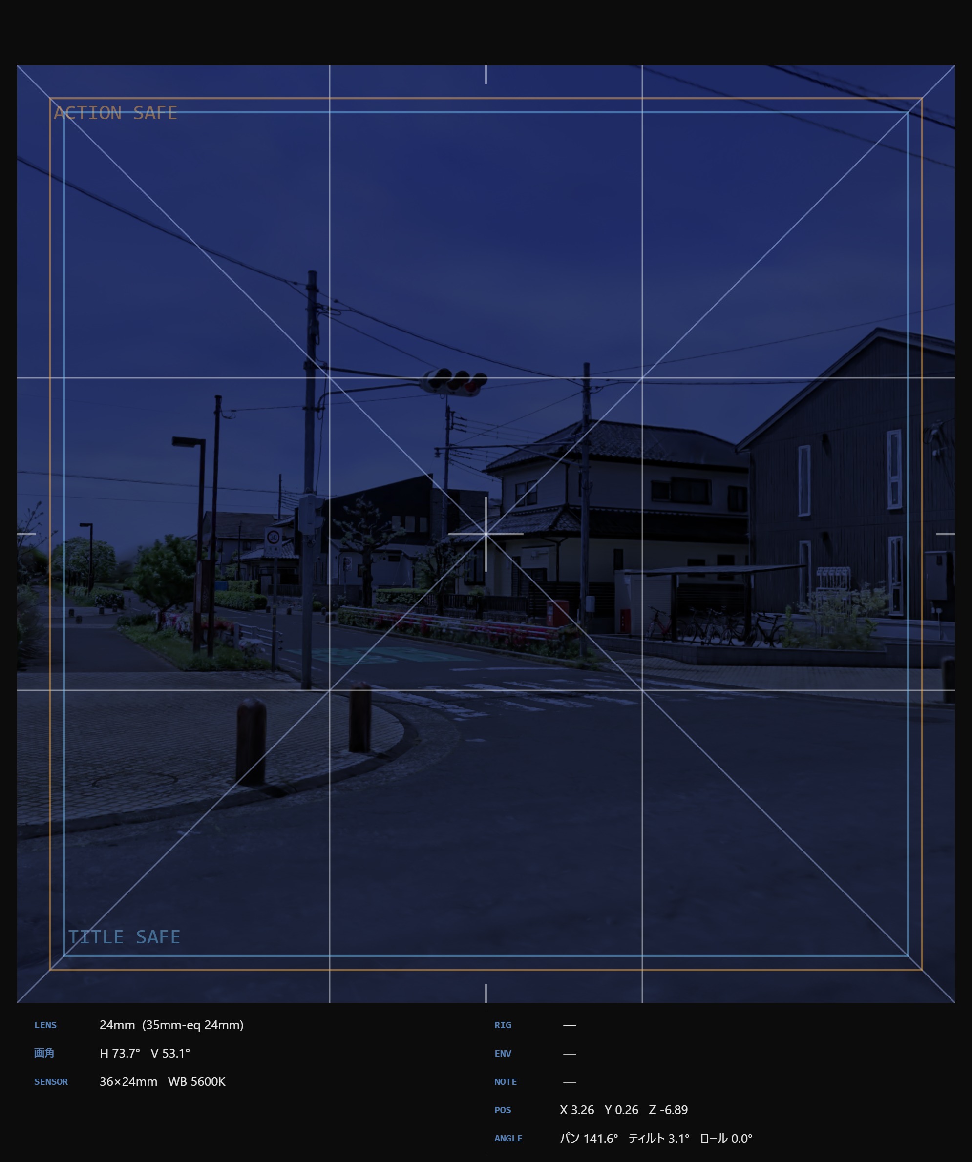
With a 3DGS scan and a virtual camera, try sensor, focal length, pan/tilt, and time of day before the shoot. On the day, you're ready to press the shutter without hesitation.
— 6 USE CASES —
6 scenes where it makes a concrete difference on the camera department's set
UC-01
Lens selection and focal-length trials
Compare 14/24/35/50/85mm at the same viewpoint and same subject distance. Lock the lenses you'll bring before the shoot.
UC-02
Composition with grid overlays
Rule of thirds, golden ratio, diagonal, AE-compatible safe, custom. With multiple simultaneous overlays, find the optimal composition before the shoot.
UC-03
Lighting study by time of day and weather
Recolor with pseudo-HDRI for morning, noon, dusk, night, and rain. Check sun position, shadow length, and reflection direction before the shoot.
UC-04
Movement checks for special equipment
Crane, gimbal, drone, Steadicam — simulate camerawork inside the 3D space in advance. Lock safety, runtime, and sightlines.
UC-05
Angle consensus with the crew on set
Director, AC, focus puller, sound — build the "this is the shot" agreement before the shoot off the same JPEG.
UC-06
Salvaging the position of past shots
Drop a past JPEG and camera position, angle, focal length, and WB all restore instantly. Return to the exact spot, again and again, for sequels and retakes.
— BENEFITS FOR THE CAMERA CREW —
Make the difference with lens, composition, and salvage
PIPE 01 / LENS
Confidence in lens selection
Walk into the shoot having tried all of 14/24/35/50/85mm. Optimize the lens package you bring to set.
PIPE 02 / GRID
Composition grids
Rule of thirds, golden, diagonal, AE-compatible safe, custom — study composition with multiple overlays. AE integration keeps it consistent with post.
PIPE 03 / SALVAGE
Position salvage
Drop a past JPEG and that day's camera position, angle, and all settings restore instantly. Call back the decisive shot for sequels, retakes, and replacements.
— VIRTUAL CAMERA · LENS / SENSOR / WB / PTR
For 05— VFX PRODUCTION —
The final alignment of live action and CG, captured on location.
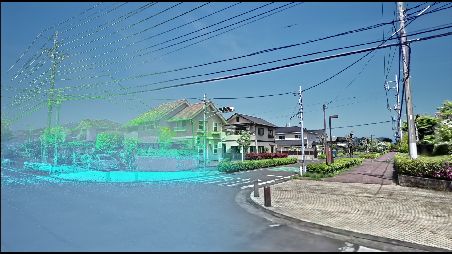
Take the location home in 3DGS at real scale and real coordinates, and use it directly as a 3D tracking reference, perspective baseline, and environment-light reference.
Feed location-based grounding data into your Blender / Maya / Houdini / Nuke / After Effects pipeline.
— 6 USE CASES —
6 scenes where it makes a concrete difference in VFX production
UC-01
A reference for 3D camera tracking
Because 3DGS is captured at real-world scale, it can be used as-is as a tracking reference for Mocha / SynthEyes / 3DEqualizer. Matchmove alignment accuracy rises.
UC-02
A perspective baseline for plate compositing
The grounding data for scale and perspective alignment when placing CG elements onto live-action plates. A starting point for 3D-layer design in AE / Nuke.
UC-03
Environment-light / HDRI reference
Because 3DGS records the look at the time of shooting as-is, it works as lighting reference material and a pseudo-HDRI starting point. You can fill in an HDRI you failed to capture.
UC-04
Mesh and texture extraction
Conversion from 3DGS to mesh + texture is also supported. There's a path to rebase props and set elements as VFX assets.
UC-05
Previs / layout
Import into Unreal / Blender and place CG characters and mecha in the real space. Lock movement, runtime, and angles before the shoot.
UC-06
Archiving and reusing past assets
Sequels, replacements, and spin-offs at the same location or set. 3DGS is a permanent asset you can reuse any number of times.
— INTEGRATION WITH MAJOR DCC / COMP TOOLS —
Inject it straight into the VFX pipeline
PIPE 01 / 3D
Blender / Maya / Houdini
Load .ply via a 3DGS add-on or plugin. For 3D tracking reference, perspective matching, and lighting reference.
PIPE 02 / TRACK
Mocha / SynthEyes / 3DEqualizer
Pass camera-tracking data exported against the real coordinates of the 3DGS, and lift alignment accuracy.
PIPE 03 / COMP
After Effects / Nuke
As a scale and perspective baseline for 3D layers. FHD JPEG (with metadata) works as standing project reference material.
— POINT CLOUD · CM-LEVEL · REAL SCALE
For 06— STUDIO OPERATION —
Exhibit your studio in 3D. Fill the lost opportunities of distance and peak season.
For operators of rental studios, house studios, and shoot-ready facilities.
Scan your property once in 3DGS and it directly drives in-browser viewings, inquiries from afar, and better discoverability during vacancies.
It also lays the groundwork to broaden your exposure to production teams on the upcoming locahun3d.com.
— 6 USE CASES —
6 scenes where it makes a concrete difference for studio operators
UC-01
In-browser viewings
Production teams can check the property in 3D without visiting. No scheduling, no in-person viewing — show the facility with a single web URL.
UC-02
Winning distant and regional productions
A Kansai or Kyushu production considers a Kanto property; a Tokyo production considers a facility for regional shoots — evaluated across distance. Your inquiry base widens.
UC-03
Monetizing vacancies and the off-season
An always-on online exhibit via a 3DGS link. Awareness during the off-season and vacancies grows, lifting utilization.
UC-04
Private mode
Sensitive properties are viewable by invite link only. Switch public/private per project. Reconcile confidentiality and reach.
UC-05
Repeat relationships with productions
Productions that have shared the 3DGS data across their team come back to the same facility more easily. Named bookings happen for sequels, replacements, and annual projects.
UC-06
Listing on locahun3d.com (planned 2027)
Win bookings from productions + search traffic through marketplace features. Early partners are slated for preferential treatment with launch listing slots.
— HOW IT ROLLS OUT —
One scan, turned into a permanent asset
STEP 01 / SCAN
Free or low-cost scan
As an early-partner condition, scan costs are discounted. A 30–60 minute walkthrough turns the whole facility into 3DGS.
STEP 02 / DELIVER
Just receive a URL
Within 1–2 business days of the scan, we deliver a single dedicated URL. No server setup or hosting — just paste it into email / social / your own site for zero operational overhead.
STEP 03 / GROW
Marketplace integration
At the locahun3d.com launch, listed with priority as an early listing slot. Prioritized in the design of the fee model and booking flow.
— BROWSER WALKTHROUGH · NO INSTALL · URL ONLY
Start with a 30-minute live demo, tailored to the context of your set.
If you can share reference material from your project, we'll prepare a scan example + app demo matched to that context and bring it to you.